11/3/2011 - Did this one in my attempt to see if the falls in Warwoman Dell, Becky Branch Falls and this one could be done in one day. Turned out it's quite doable! I did get some new photos, but it's hard to tell if I got any new ones, or even all the ones I got before - except! As you are hiking up the hill on the shortcut route you can distinctly hear what seems to be a good sized falls that you just can't see. Turns out you CAN see, by hiking up the road from the parking area 1/10 mile to where you can veiw 2 quite sizable falls - one above the other!
7/17/2011 - Went back to Martin Creek to get the GPS points and pictures of the falls I didn't get before. There were a lot more than I remembered! Some of them are hard to see, but as usual when you are there the water catches your eye and makes them easier to find. This time I followed the instructions on Mr. Anthony's site, because it's a lot shorter hike. Too darn hot to do a long hike!
I found 10 new falls altogether, in addition to Martin Creek Falls. There are 2 or 3 places where it sounds like there might be other falls, but the creek is hidden from view by the overhanging bank - so I can't be sure.
The shorter trail that Mr. Anthony has starts in a camping spot, and then crosses Martin Creek. It goes upstream for a little way that is level, then it starts the climb up to the valley. It's not a bad climb. At the top of the hill the Bartram Trail comes in from the left and you stay on this trail upstream all the way to Martin Creek falls.
The Bartram Trail crosses the creek, though it's not really necessary to do this, as it goes to the deck at Martin Creek Falls and then does a U-turn back almost to the first bridge...but staying on the trail and crossing the creek gives you a better view of the small falls below Martin Creek Falls.
5/22/2010 I got to these falls, via the Bartram Trail out of Warwoman Dell east of Clayton, GA, on a hike with the TrailDames. This is about a 1.8 mile (3.6 round-trip) hike to Martin Creek Falls, that goes past Becky Branch Falls just 1/4 mile from Warwoman Dell. Both falls are beautiful and well worth the hike. There are also several smaller cascades along the creek on the way to Martin Creek Falls. (see also the entry about the falls in Warwoman Dell)
The trail is not too difficult, more or less ordinary mountain hiking in Georgia - up and down, up and down! Just before the viewing platform for the falls, you cross a "picked clean" camping area and can either cross the creek on the bridge to get to the falls, or stay beside the creek and get to it that way, without crossing the bridge. If you stay on the campground side, and hike past the side trail to the falls, there is a short, steep trail to the top of the falls and a small place that is nice for a picnic
I discovered the first falls are visible from the road, above the parking, but are not visible from the shortcut trail up the valley. This might not be on Martin Creek. GMAPS shows a creek coming in from the side and these falls might be on that unnamed creek.
GPS: 34°53'31"N 83°20'38"W

Upper
Lower
GPS: 34°53'29"N 83°20'42"W


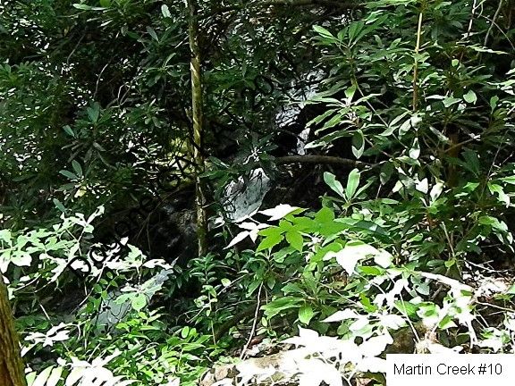
This is the 2nd falls, buried in rhododendron.
GPS: 34°53'29"N 83°20'43"W
GPS: 34°53'29"N 83°20'43"W

These 2 falls are very close together...buried in rhododendron, of course!
GPS: 34°53'28"N 83°20'45"W


Here's the 5th falls...I won't mention the rhododendron again!
GPS: looks like I missed this one

These are 2 different angles on the same falls comples. The 2nd is taken from just a bit closer than the first.
GPS: missed this one too


GPS: and this one

Between the 6th falls and the next set of falls there is a long gap as the trail continues upstream along a more or less level high valley. Then the trail crosses Martin Creek, so the next falls are from the other side...and the main falls, Martin Creek Falls, is at the head of the valley.
These are numbers 7 and 8 - very close together
GPS: 34°53'33"N 83°20'56"W


And this is the last small falls, then you cross the bridge back over the creek to the deck at the base of Martin Creek Falls.
GPS: 34°53'33"N 83°20'56"W
GPS: 34°53'34"N 83°20'57"W

Directions and Information: from Clayton, GA
- east on Rickman St
- (if you miss Rickman St, Warwoman Rd is the next road to the right)
- at 5 way junction, bear right onto Warwoman Rd
- left on Finney Creek Rd
- park at campsite on left, where road starts up steepish hill
No comments:
Post a Comment