What this is all about

I like to hike, and I belong to a womens hiking group called "TrailDames" - one of our hikes took us to a waterfall just over the border in South Carolina. This got me interested in finding waterfalls nearby and earlier this year I found a website with directions and photos of waterfalls in North Georgia at (see links for TrailDames & North Georgia Waterfalls below)

I now also belong to another womens hiking group called Off the Grid. Both OTG and Traildames are on Meetup.

Mr. Anthony's site has lovely photos of well over 100 waterfalls in North Georgia and I got interested in seeing them. As the weather got hotter through the summer I concentrated on shorter hikes to falls, and falls that were visible from the road. Then, as it started to get cooler again, I started doing longer hikes. It turned out to be far more fun than I expected it to be, and to my surprise - when I added them up - I had been to over 100 myself!

So I decided to make a record of them and of what it's like to visit them, in case anyone else is interested in seeing them too. I will be adding photos and directions, trail conditions, etc. in the future. As I "redo" falls I will update the page that already exists for them, instead of creating a new page every time. Keeping with the format of this blog site, I will put new information at the top of each existing page.

I won't be putting road mileages on the directions, I strongly urge you to compare my directions to a good map so you can see the distances for yourself. I'm not very good at guessing distances, so if I can find a trail length I will use that. If I'm guessing, I'll put a question mark so you'll know!

My apologies for the "watermarks" on the photos, but I have had...and know other people who have had...photos stolen off the net. The watermarks are to ensure that they can't be reused without being identified as mine.

I got a good GPS unit and I'll slowly be putting GPS coordinates for the falls, when I can. If I can get close to the falls the GPS will be for the falls. Otherwise, it will be for where you can see them most easily.

Nov 2012: I got a new PC and now that I can actually get things done (!) I'm going to rearrange the way the falls are listed. I'm going to list them separately, instead of grouping them by the day I saw them. The only ones I'll group are the ones that are on the same creek, or very close - like on the same road.

I've completed rearranging the posts. Hopefully this will help make the falls easier to find. I also found my count was WAY off, so I've updated the total too.

Jan 2013 - I just got a video camera, so I'll be adding short videos of the falls as I am able to get back to them. They might be a bit shakey at first, but hopefully I'll get better as I get used to using it!

Jan 2014 - I almost forgot about posting this! I had been in contact with Sharon Collins, the host of GPB's "Georgia Outdoors"...offering to take her around my 18 Waterfalls tour. She was not able to make it, but I did take her cameraman Shane Keating on the tour. I was hoping they'd do a show about the tour, but that didn't happen. However, some of the shots did show up in the episode "Mountain Magic"...so I've added a link to that episode.

Aug 2015 - I've created a Google map of the waterfalls I either have been to, or know about as publicly accessable, check it out at: https://goo.gl/maps/79Lyb

Got some additional news. The episode of Georgia Outdoors mentioned above, that has some of the shots taken by the cameraman on my 18 Wateralls tour...won a 2015 Southeastern Emmy for "Magazine Program" http://www.gpb.org/emmys

Total Falls

Total waterfalls as of 6/7/2015: 504
Total videos as of 6/7/2015: 180

Sunday, February 13, 2011

Coleman River Trail falls (8 falls)

2/13/2011 - Coleman River Trail falls

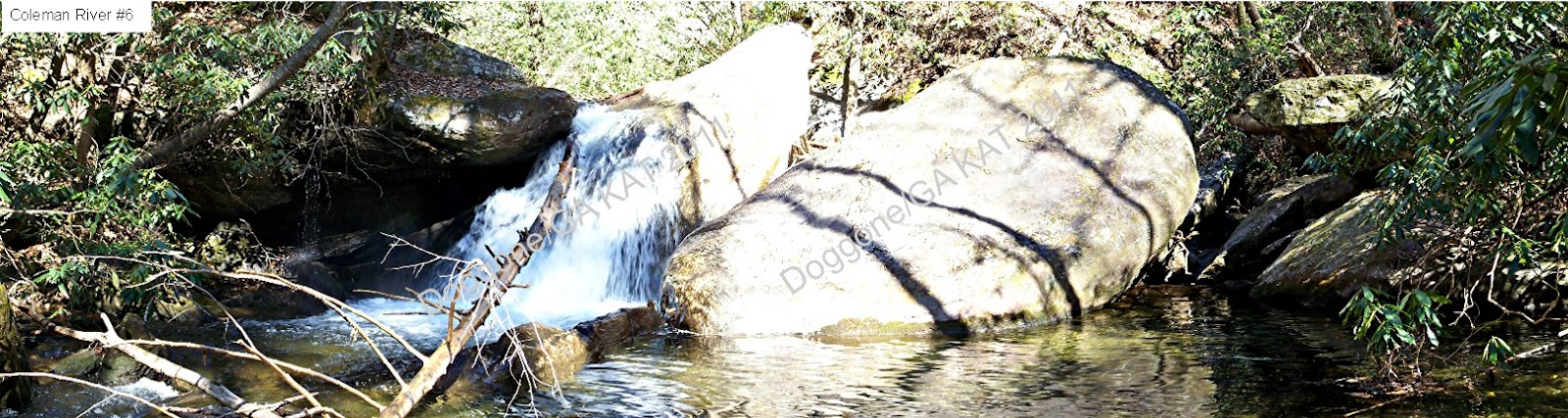
This trail is accessed from FS 70 (Tallulah River Rd.) along the upper Tallulah River.  It's a short trail, supposed to be 1 mile...but I didn't go that far in.  I came to a point, just after a bridge in very bad repair, where I'm sure there is a big falls...but the trail became MUCH steeper at this point and I didn't want to try it when I was alone.  What sounds like a falls at this point might be quite big (it has a deeper note to it's sound) but the rocks and the rhododendrons conspire to hide it almost completely, so I didn't count it.

This is a very pretty river and could easily be combined with a hike up the Tallulah River itself.  It only took me 30 minutes to hike out from the point where I stopped, as it's all down hill.  I don't know how long it took to hike in, because for 3 of the falls I had to bushwhack down the hill to the river to get better pictures, so that ate up some time.  That plus stopping so often to get pictures of the others!

Several websites I checked complained about the bad shape of the bridges on this trail, but the Forest Service has been doing some work.  I crossed one completely new bridge, and one older one that has a brand new railing.  The last bridge I crossed was in bad shape, no railing and missing several boards...but I'm thinking they just haven't gotten that far in yet.  I also saw signs where some blow downs had been cleared out of the way.

I don't know how much further in it goes from where I turned around, but the above mentioned websites say it just stops in a patch of rhododendron.


Directions & Information: from Clayton, GA
  • west on US 76
  • right on Persimmon Rd
  • left on Tallulah River (FS 70)
  • park at entrance to first campground (Sandy Ford)
  • walk upriver to first bridge (crosses the Coleman River)
  • trail is to right before bridge
Note: parking along FS 70 is at designated spaces only, so even though it looks like there is room to park at the trail head, the closest parking is at the entrance to Sandy Ford camping area.  There is also parking about 100 yards past the bridge over the Coleman River

4 comments:

Anonymous said...

These look like places in PA, too. I'm curious as to why you have the, is it watermarks, on the pictures?

Cheers, Lady Di

Doggone/GA said...

I have the "watermarks" because I had a picture "stolen" from me at one time and claimed by the other person as theirs. This way, if they are taken, they always have my ID on them

Joan West said...

We did this trail in early June, and the wildflowers were outstanding. The trail faded out in a thicket of rhododendrons, but there was a nice sized cascade, though I recall doing scrambling to get to it.

Doggone/GA said...

Hemlock - thanks! Sounds like I need to go back and do that steeper part after all! And I had already decided to go back when the rhododendrons are blooming, it's bound to be spectacular!