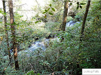
9/22/2012 - went back to see if I could get better photos of these falls. It takes a special kind of nut to drive 200 miles to do a 1 mile hike! It was hard to get a better photo of Pigpen Falls, as a small tree has become bent over right at the best spot to take a photo without having to get in the plunge pool. I did get a better one of Licklog Falls, and I even got a small falls that is on the trail in to Pigpen Falls.
I also took as good a shot as I could of the upper falls of Pigpen Falls. I tried to find a way to get closer, but just couldn't manage it. So it's hard to see in the photo, and unfortunately the angle makes it look flatter than it is, but when you are there it's clear there IS an upper falls!
According to GMAPS these falls are on Pigpen Branch
2/12/2011 - These falls are found along a trail in the Chattooga River Trail system. This was the hike that inspired me to start searching out waterfalls, so I decided to add them. The picture of Licklog Falls isn't as good as I could wish, the angle was from above and the camera had a lot of trouble with how bright the water was. This is another one that will go on my redo list!
GPS: 34.92810°N 83.12504°W3
GPS: 34.92848°N 83.12905°W
GPS: 34.92984°N 83.13098°W
Directions and Information: from Clayton, GA
- east on Warwoman Rd - to end
- right on GA hwy 28 - becomes Highlands Hwy in SC
- left on Village Creek Rd
- hard left on Nicholson Ford Rd (my map also says CH 50)
- after fording small creek - parking is on the right
- there is also parking further down the road, at the end
Note: hike more or less north on the trail, past 2nd parking area, keep an eye out for an sharp left turn...this goes down to Pigpen Falls. Licklog Falls is further down this trail, after crossing the bridge across the creek - as the trail starts down hill. If you park at the end of the road, the trail is straight ahead, through the parking area...don't take the trail that goes up some log steps - that goes back to the first parking area.


No comments:
Post a Comment