What this is all about

I like to hike, and I belong to a womens hiking group called "TrailDames" - one of our hikes took us to a waterfall just over the border in South Carolina. This got me interested in finding waterfalls nearby and earlier this year I found a website with directions and photos of waterfalls in North Georgia at (see links for TrailDames & North Georgia Waterfalls below)

I now also belong to another womens hiking group called Off the Grid. Both OTG and Traildames are on Meetup.

Mr. Anthony's site has lovely photos of well over 100 waterfalls in North Georgia and I got interested in seeing them. As the weather got hotter through the summer I concentrated on shorter hikes to falls, and falls that were visible from the road. Then, as it started to get cooler again, I started doing longer hikes. It turned out to be far more fun than I expected it to be, and to my surprise - when I added them up - I had been to over 100 myself!

So I decided to make a record of them and of what it's like to visit them, in case anyone else is interested in seeing them too. I will be adding photos and directions, trail conditions, etc. in the future. As I "redo" falls I will update the page that already exists for them, instead of creating a new page every time. Keeping with the format of this blog site, I will put new information at the top of each existing page.

I won't be putting road mileages on the directions, I strongly urge you to compare my directions to a good map so you can see the distances for yourself. I'm not very good at guessing distances, so if I can find a trail length I will use that. If I'm guessing, I'll put a question mark so you'll know!

My apologies for the "watermarks" on the photos, but I have had...and know other people who have had...photos stolen off the net. The watermarks are to ensure that they can't be reused without being identified as mine.

I got a good GPS unit and I'll slowly be putting GPS coordinates for the falls, when I can. If I can get close to the falls the GPS will be for the falls. Otherwise, it will be for where you can see them most easily.

Nov 2012: I got a new PC and now that I can actually get things done (!) I'm going to rearrange the way the falls are listed. I'm going to list them separately, instead of grouping them by the day I saw them. The only ones I'll group are the ones that are on the same creek, or very close - like on the same road.

I've completed rearranging the posts. Hopefully this will help make the falls easier to find. I also found my count was WAY off, so I've updated the total too.

Jan 2013 - I just got a video camera, so I'll be adding short videos of the falls as I am able to get back to them. They might be a bit shakey at first, but hopefully I'll get better as I get used to using it!

Jan 2014 - I almost forgot about posting this! I had been in contact with Sharon Collins, the host of GPB's "Georgia Outdoors"...offering to take her around my 18 Waterfalls tour. She was not able to make it, but I did take her cameraman Shane Keating on the tour. I was hoping they'd do a show about the tour, but that didn't happen. However, some of the shots did show up in the episode "Mountain Magic"...so I've added a link to that episode.

Aug 2015 - I've created a Google map of the waterfalls I either have been to, or know about as publicly accessable, check it out at: https://goo.gl/maps/79Lyb

Got some additional news. The episode of Georgia Outdoors mentioned above, that has some of the shots taken by the cameraman on my 18 Wateralls tour...won a 2015 Southeastern Emmy for "Magazine Program" http://www.gpb.org/emmys

Total Falls

Total waterfalls as of 6/7/2015: 504
Total videos as of 6/7/2015: 180

Sunday, April 20, 2014

Ward Creek falls (2 falls)

2/22/2014 - went to scout the Forest Service road to Long Creek Falls, and since I was more or less in the area I went to get a videos of Ward Creek Falls.  My knees are doing better, but are still not well and I wasn't ready to try to get down and do the lower falls, but at least I did get the falls by the road.

As Mr. Anthony says, this falls (the upper falls) looks bigger in photos than it actually is. It's pretty easy to see from the Forest Service road, in the winter and fall, but in spring and summer it's easy to miss if you don't know where it is.


Directions and Information: from Dahlonega, GA
  • north on US 19 bypass
  • left on Camp Wahsega Rd
  • at Camp Merrill - right on gravel road (FS 80/Coopers Gap Rd)
  • at top of mountain, right on Forest Service road 42 (FS 42)
  • falls are 1 mile on left
Note: Camp Wahsega Rd is blocked, at the end, alternately right & left by traffic dividers - to protect the entrance to the camp. Just go around them and then right on the gravel road. Watch your odometer after you turn onto FS 42, the falls might be hard to see in spring & summer

Tuesday, April 15, 2014

Fall Branch Falls & Stanley Creek Falls (10 falls)


4/5/2014 - took a small Meetup group to see these falls.  The weather was really nice and there were LOTS of people there that day.  Looks like I missed a falls, but picked up one I didn't have before!  Guess I'll have to go back again and double-check.

9/19/2012 - went back to this area to find Stanley Creek Falls - which is near the trailhead for Fall Branch Falls.  Turned out to be pretty easy to find.  Driving West on Rock Creek Rd, right at 1/2 mile from the trail to Fall Branch Falls...there's an old road.  Park here and hike down the road and you'll hear the falls.  They're not very far, maybe 1/4 mile...and not very big, but very pretty.

I also found a small, complex falls right beside Rock Creek Rd., about 1 3/4 miles further West from the old road to Stanley Creek Falls.

7/3/2011 - went back to Fall Branch Falls to get the GPS points and found that there are quite a few smaller, sliding falls on this same branch.

7/17/2010 This falls is on a short, steep trail that is part of the Benton Mackaye Trail.  There is a short side trail to the viewing area.  You can also hike further up the trail and, with care, get down to the creek to see some smaller, but pretty shoals. 
GPS: 34°47'3"N 84°18'8"W
GPS: 34°47'4"N 84°18'12"W


It's hard to see in the photo, but this falls is wider than it looks.  There's quite a bit more behind the fallen log that is near the center of the photo.
GPS: 34°47'5"N 84°18'14"W
GPS: 34°47'6"N 84°18'16"W


Falls 5 is hard to see in the photo, it actually goes from just above the middle on the left side to the white spot near the right side.
GPS: 34°47'9"N 84°18'19"W
GPS:34°47'9"N 84°18'19"W


GPS:34°47'10"N 84°18'20"W (both)

Fall Branch Falls


Stanley Creek Falls
GPS: 34.77935°N 84.30779°W
Rock Creek falls
 GPS: 34.78161°N 84.33588°W
Directions and Information: from Blue Ridge, GA - US 76
  • south on Hwy 76 connector
  • left on Veterans Memorial Hwy
  • right on Aska Rd
  • right on Stanley Creek Rd
  • well after pavement ends, will cross creek, park here
  • trail is old road, follow upstream
  • right on side trail to viewing platform

Thursday, December 26, 2013

Padgett Falls

12/25/13 - went back to get a better video of this falls.  I walked up and down the road and there are 2 places where you can get a pretty good view of it.  One is at the curve, as described below.  The other is back up the road just where it starts downhill more steeply, just over a very small rise in the road.  The lower point gives a better view of the upper part of the falls.  The upper point gives a better view of the lower part of the falls.

2/8/13 - my sister and I went up to Rock City (first time I've been there) and on the way back we stopped and took videos of Padgett Falls.  I did take some still pictures too, but those didn't turn out verry well.

12/23/2011 - such a beautiful day, decided to take it easy and do a roadside falls.  Went back to Padgett Falls to get better pictures.  Winter is definitely the best time to see this falls.  I had forgotten just how big it really is!  We had a lot of rain in the last few days, so this one was really spectacular this time.

GMAPS does not show a name for this creek, but it flows into Pettit Creek

11/24/2010 Saw a reference to this falls when I was searching the net for GA waterfalls.  It's on heavily posted private property behind the airport in Jasper, GA

The 2 GPS points are the spots on the road that have the best views of the falls.
GPS: 34.45164 -84.46881 (upper)
GPS: 34.45166 -84.46879 (lower)


Directions and information: Padgett Falls is on private property, which is heavily posted..but actually the best view is from the road anyway 
  • From hwy 515 in Jasper:
  • turn west on W. Church St
  • turn left on Camp Rd
  • turn right on Upper Salem Rd
  • follow around behind airport - where it takes a right angle turn and become a dirt road
As you go around a tight curve to the right you will see a leveled spot, on the right, where a mobile home used to be - continue past and as road begins to curve left...stop and look down into the valley, falls should be visible but please note: this is a well-forested area and they may not be visible when the trees and bushes are in leaf.

Sunday, November 24, 2013

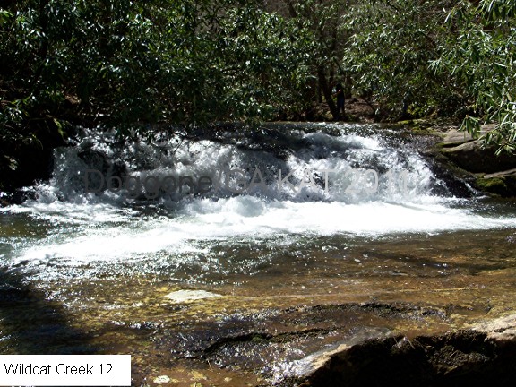
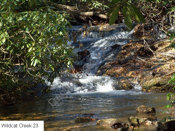
Wildcat Creek Rd (25 falls)

11/24/2013 - have off all this Thanksgiving week, so I went out and got some waterfall videos.  There are SO many falls on W. Wildcat Rd. that I'm finding it difficult to keep them in order and to get them all!  I thought I had it this time, but it looks like I need to go back yet again!

4/13/2013 - Wildcat Rd has been closed for 2 years, because of the tornados in 2011.  A couple/three weeks ago I was in the are and checked and the road was finally open again.  So I went up today to get videos.  There has been a lot of rain and the falls were just gorgeous, with lots of water coming over.  I didn't get all the falls...didn't find out until I got there that the battery on my camera was really low, but I did get as far as the waterslide falls.

5/1/2012 - a week after my previous post this area was hit hard by a tornado - Apr 28, 2011 actually.  Wildcat Rd. has been closed since then with no indication when it will be reopened.  I drove down it and it's closed just past the last private property access.

Creek names below are all from GMAPS

4/2/2011 - BIG update on Wildcat Road!  I went back to get new pictures and to drive with my windows open (FS 44 taught me to do that!) and I got 21 (!) falls I had missed before.  Very exciting!  Because I got so many new ones, I'm redoing this completely, and pushing the previous info to the very bottom.

7/31/2010 Drove up the gravel road that runs alongside Wildcat creek, which is not too far from Moccasin Creek State Park.  There are quite a few falls and cascades on this creek, some of which - but not all - are on Mr. Anthony's site.  My pictures got mixed up, so may not be in the correct order - but I plan to go back on a good day and redo them all to get them in order, and to get better pictures.

I'm pretty sure I missed some falls on 4/1/2013 - so I'm rearranging things until I can get back up there and try to get them all again!  I've put all the GPS coordinates and mileages at the bottom of the page until I can re-check them.

The first 3 photos are of some of the damage done during the tornadoes in 2011.  These were taken right at the beginning of the road, just after the end of the paved part.


 These got all out of order...I'll go back soon and redo all the photos and make sure I get them in order!


The first 4 falls are very close together, starting at .9 mi and from there to about 1 mi.

GPS: 34°50'0"N 83°35'53"W (Wildcat Creek)
GPS: 34°50'4"N 83°36'3"W (Wildcat Creek)
At 1.7 mi there are 3 falls that are close together in the next 1/10 mi
GPS: 34°50'5"N 83°36'6"W (Wildcat Creek)
GPS: 34°50'5"N 83°36'7"W (Wildcat Creek)
GPS: 34°50'6"N 83°36'12"W (Wildcat Creek)
At 1.8 mi is another falls
GPS: 34°50'6"N 83°36'15"W (Wildcat Creek)
At 1.9 mi there are 2 falls close together
GPS: 34°50'9"N 83°36'16"W (Wildcat Creek)
GPS: 34°50'4"N 83°36'18"W (Wildcat Creek)
At 2.0 mi there is a double falls divided by a shelf of rock (an eroded area in the road verge leads down to the shelf), and above that a short way is a popular waterslide falls that kids like to play on.
GPS: 34°50'6"N 83°36'20"W (Wildcat Creek)
GPS: 34°50'7"N 83°36'21"W (Wildcat Creek)
GPS: 34°50'1"N 83°36'21"W (Wildcat Creek)
At 2.2 mi is the first bridge on Wildcat Rd.  It crosses a side creek and upstream of the bridge is a falls
GPS: 34°50'4"N 83°36'45"W (Wildcat Creek)
Note: from this bridge to the next bridge at it sounds like there might be several falls, but the road is too high above the creek and the rhododendrons are too thick to see anything.  And the valley is too steep to climb down without climbing equipment!
At 3.6 miles there are, again, 3 falls fairly close together in the next 1/10 mi
GPS: 34°50'4"N 83°36'58"W (Wildcat Creek)
GPS: 34°49'37"N 83°36'59"W (Wildcat Creek)
GPS: 34°49'37"N 83°37'1"W (Wildcat Creek)
At 3.7 mi there is a small falls, with a long sliding shoals just below it
GPS: 34°49'35"N 83°37'5"W (Wildcat Creek)
At 3.8 mi there is another long, curved falls
GPS: 34°49'38"N 83°37'10"W (Wildcat Creek)
At 4.3 mi the road begins a steady uphill and there is an more open area between the road and the creek.  There are at least 4 falls coming down at this point.  To see the lower falls, you need to bushwhack across this open area to the creek.  To see the next 2, stop about halfway up the hill.  To see the top falls, there is a small parking area at the top and you can get down to the creek there.
GPS:34°49'41"N 83°37'26"W (Wildcat Creek)
GPS: 34°49'42"N 83°37'28"W (Wildcat Creek)
GPS: 34°49'44"N 83°37'33"W (Wildcat Creek)
GPS: 34°49'46"N 83°37'32"W (Wildcat Creek)
GPS: 34°49'47"N 83°37'33"W (Wildcat Creek)
At 6.1 mi there is another falls, might actually be a long one...but all you can see are glimpses of the moving water - so no picture, but it's there!  Part of it appears to be in a slot, but it's hard to get a good look at it.
GPS: 34°50'44"N 83°37'44"W (Jessie Branch)
At 7.3 mi there is a falls that might be long, but all that could be photographed was the small falls at the top.
GPS: 34°51'25"N 83°38'6"W (Mandy Branch)
At 8.3 mi another long falls, but could only get a photo - again - of the small falls at the top
GPS: 34°51'38"N 83°38'51"W (South Fork Moccasin Creek)

I would say that there are probably something like 30 or more waterfalls along this creek, but you just can't see them all.

Directions and Information: from Clarkesville, Ga
  • north on GA 197
  • left on West Wildcat Road
Note: there are many small falls and shoals along this creek.  Continue towards campground 2 (CG 2) and as you get close and ascend a steepish hill watch for a fairly open area to the right.  There is a falls with several cascades here.  At the top there is a wide area where you can park and get out on top of the falls.  Upstream is another small falls.  You can bushwhack downhill through the open area and get to the creek to view the other cascades.

Friday, November 22, 2013

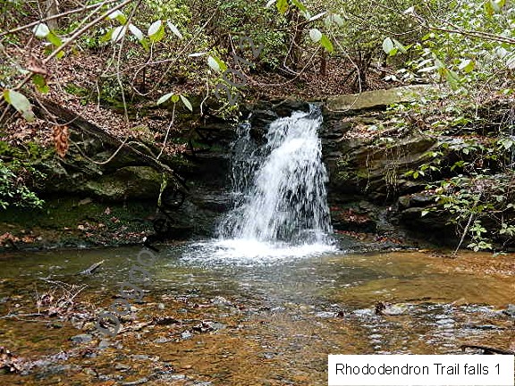
Rhododendron Trail (6 falls)

3/8/2014 - went back to the Rhododendron Trail to try to get better videos of the distant falls.  I think I have them in the right order!  I realized as I was filming that there was an even lower one that I have missed on past trips.  So that increases the total to  6 falls, but now I don't have still shots of them all - guess I'll have to go back yet again!

11/22/2013 - took advantage of being off for over a week for the Thanksgiving holiday and went out to get videos of waterfalls.  Had time to take a good look at the distant falls, using the zoom on my video camera and I'm pretty sure they are 2 separate falls.  I was not able to get a good video of the upper falls, but the lower one came out ok.

1/25/2012 - my sister and I went back to the Rhododendron Trail at the Lake Russell end to scout the trail for a TrailDames hike and to get new pictures.  Got much better ones with the leaves off the trees!  And we found another one that I completely missed the first time I was there.  This time of the year the falls are much easier to spot.

6/26/2011 - stayed a bit closer to home this time and went up to the Lake Russell area to try the western half (or so) of the Rhododendron Trail, that starts in Cornelia and ends at the road down into the Lake Russell area.

There's no sign at this end for the trail, but it begins right at the sign that says "Fee Area ahead." (GPS: 34°30'5"N 83°29'23"W)  There's not any parking to speak of, but there's enough room on the verge for maybe 3 cars.  It's hard to tell there's a trail here, but when you look down from the road, you'll see a new wooden bridge and that's the trail

This was a pretty easy hike.  It does go steadily uphill along what looks like an old logging road, but none of the hills was really steep or long.  My GPS said I did just under 2 miles total, and it took me about 1 1/2 hours - and that includes stopping for photos, and bushwhacking over to the first falls.

As you hike in, once you turn up the valley and get out of ear-shot of the road, you'll start to hear the sound of water.  Keep hiking until it gets about as loud as it's going to get, then bushwhack a short way to the left, to the creek, and there is a small falls there.

Cascade Falls is at about .71 miles and at about 1.03 miles (GPS: 34°30'31"N 83°30'0"W) is the narrow side trail, on the right, to the falls on the side creek.  Cascade Falls is hard to see in the photo, but as usual, is easier when you are there.  I'll have to go back after the leaves drop and see if I can get a better shot.

GMAPS does not show the names of the creek for these falls, but it flows into Lake Russell

GPS: 34°30'14"N 83°29'39"W

GPS: 34°30'20"N 83°29'48"W

GPS: 34°30'33"N 83°30'0"W
This video is of the bottom falls in the still photo...just to the right of the big tree on the left side.


At the Cornelia end of the Rhododendron Trail is this nice trail map.

 Directions and Information: from US 441/23 north of Gainesville
  • exit right onto GA 197
  • at bottom of exit ramp, turn right
  • road ends at T junction, turn right
  • left on Lake Russell Road
  • watch for small wooden bridge on right
  • park here