What this is all about

I like to hike, and I belong to a womens hiking group called "TrailDames" - one of our hikes took us to a waterfall just over the border in South Carolina. This got me interested in finding waterfalls nearby and earlier this year I found a website with directions and photos of waterfalls in North Georgia at (see links for TrailDames & North Georgia Waterfalls below)

I now also belong to another womens hiking group called Off the Grid. Both OTG and Traildames are on Meetup.

Mr. Anthony's site has lovely photos of well over 100 waterfalls in North Georgia and I got interested in seeing them. As the weather got hotter through the summer I concentrated on shorter hikes to falls, and falls that were visible from the road. Then, as it started to get cooler again, I started doing longer hikes. It turned out to be far more fun than I expected it to be, and to my surprise - when I added them up - I had been to over 100 myself!

So I decided to make a record of them and of what it's like to visit them, in case anyone else is interested in seeing them too. I will be adding photos and directions, trail conditions, etc. in the future. As I "redo" falls I will update the page that already exists for them, instead of creating a new page every time. Keeping with the format of this blog site, I will put new information at the top of each existing page.

I won't be putting road mileages on the directions, I strongly urge you to compare my directions to a good map so you can see the distances for yourself. I'm not very good at guessing distances, so if I can find a trail length I will use that. If I'm guessing, I'll put a question mark so you'll know!

My apologies for the "watermarks" on the photos, but I have had...and know other people who have had...photos stolen off the net. The watermarks are to ensure that they can't be reused without being identified as mine.

I got a good GPS unit and I'll slowly be putting GPS coordinates for the falls, when I can. If I can get close to the falls the GPS will be for the falls. Otherwise, it will be for where you can see them most easily.

Nov 2012: I got a new PC and now that I can actually get things done (!) I'm going to rearrange the way the falls are listed. I'm going to list them separately, instead of grouping them by the day I saw them. The only ones I'll group are the ones that are on the same creek, or very close - like on the same road.

I've completed rearranging the posts. Hopefully this will help make the falls easier to find. I also found my count was WAY off, so I've updated the total too.

Jan 2013 - I just got a video camera, so I'll be adding short videos of the falls as I am able to get back to them. They might be a bit shakey at first, but hopefully I'll get better as I get used to using it!

Jan 2014 - I almost forgot about posting this! I had been in contact with Sharon Collins, the host of GPB's "Georgia Outdoors"...offering to take her around my 18 Waterfalls tour. She was not able to make it, but I did take her cameraman Shane Keating on the tour. I was hoping they'd do a show about the tour, but that didn't happen. However, some of the shots did show up in the episode "Mountain Magic"...so I've added a link to that episode.

Aug 2015 - I've created a Google map of the waterfalls I either have been to, or know about as publicly accessable, check it out at: https://goo.gl/maps/79Lyb

Got some additional news. The episode of Georgia Outdoors mentioned above, that has some of the shots taken by the cameraman on my 18 Wateralls tour...won a 2015 Southeastern Emmy for "Magazine Program" http://www.gpb.org/emmys

Total Falls

Total waterfalls as of 6/7/2015: 504
Total videos as of 6/7/2015: 180

Saturday, July 6, 2013

Mud Creek Falls

7/6/2013 - with all the rain we've had lately, I just HAD to drive up the Cullasaja River gorge to see the falls, and had to take this on in on the way home.

5/26/2013 - made a day of it and drove up the Cullsaja Valley (US 64) to Highlands, NC...then down NC 106/GA 246 past Sky Valley.  Since I was there, I stopped and got a video of the 2 falls at Mud Creek Falls.

5/14/2011 - went back up above Clayton, Ga to revisit some falls and try to find new ones. Did both Mud Creek Falls and Estatoah Falls part of the trip. I noticed as I was driving up GA 246, that shortly after you pass River Vista RV park there is an optical oddity where you can see Estatoah falls directly above the roof of a house and it appears MUCH bigger than it does from either back down the road, or up the road past the house. I tried to get a picture of the effect, but they didn't turn out - will have to try again.

6/27/2010 Drove up to Sky Valley, GA to see Mud Creek Falls. On the way there is a distant view of Estatoah Falls - which is on private property. Mud Creek Falls is on the grounds of the Sky Valley golf course - behind the golf shop, on Tahoe Lane. The lane turns into a gravel road and goes steeply downhill to a small picnic area at the base of the falls. There is a turn-around there, but it is posted "no parking" - so you have to park along the road and walk down. The road is now paved all the way through the turn-around.
GPS: 34°59'0"N 83°20'0"W


After heavy rain, July 2013


This second falls is a small one the is, or at least was on this day, behind a picnic table on the left as you walk down towards Mud Creek Falls.


Directions and Information: from Dillard, Ga
  • north on US 23/US441
  • right on GA 246
  • continue to Sky Valley (entrance is actually in NC)
  • right into Sky Valley-road changes names several times
  • after coming along golf course on the right, turn right onto Tahoe Rd
  • falls is at end of Tahoe Rd
Note: if you have trouble finding Tahoe Rd (it's not easy to see) continue to lodge near golf course, at desk they can direct you to the falls...if the lodge is closed (it was the last time I was there) they can help you at the golf club

Thursday, July 4, 2013

Flat Creek Falls - NC (not counted)

7/4/2013 - my sister and I decided, despite the poor weather forecast, to go up in the Cherokee, NC area to find some falls.  We tried for the overlook to view Flat Creek Falls...but the road was closed about part way in.  I checked on the 'net when we got home and found an announcement that it was closed due to sequestration.

But we got a BIG surprise before then!  Came around a curve and right before a pull-off for an overlook a small herd of ELK were bedded down and chewing their cuds.  We didn't try to get too close, afraid of spooking them.  But we probably didn't need to worry, some other photographer got closer than us and they stayed put.  But my pictures came out OK, but the ground was not tilted as much as it looks like...I just had trouble holding my camera level!  The second picture gives a better idea of the lay of the land.

It's hard to see, but the elk lying by himself has his antlers starting to grow and in velvet


Directions and Information: from Cherokee, NC - beginning of the Blue Ridge Parkway
  • north on the Blue Ridge Parkway
  • left on Heintooga Ridge Rd
Note: we didn't get to the overlook for the falls, and unfortunately I didn't think to take a GPS point where the elk were seen...but it was maybe 3 miles in.  The elk were in a cleared area on the right, just before a pull-off, overlook on the left.

Soco Falls - NC *

7/4/2013 - my sister and I didn't feel like spending the day at home, so even though the weather forecast was not good we decided to chance it and try for some falls near Cherokee, NC.  We never did get to the ones we were aiming for, but on the way to find the road to Flat Creek Falls we passed a sign that said "Soco Falls" so, of course, we stopped for a look!

The larger falls is on Soco Creek, the smaller one that is hard to see is on an unnamed side creek.
GPS (parking): 35.49288°N 83.16964°W
GPS (falls overlook): 35.49262°N 83.16981°W


Directions and Information: from Cherokee, NC 
  • east on US19 - towards Maggie Valley
  • at about 10 miles, watch for "Soco Falls" sign
  • at small pull-off on the right, stop and park
  • trail to viewing deck starts at break in the guard rail
 Note: there is a short, very steep trail that starts over the guard rail, but this is not the official, maintained trail and is probably dangerous...don't use this one!

Monday, July 1, 2013

Martin Creek Falls (14 falls)

6/29/2013 - went back to get videos of the first falls on Martin Creek.  Still can't do any hiking, so the rest of them will have to wait until my leg is better.

11/3/2011 - Did this one in my attempt to see if the falls in Warwoman Dell, Becky Branch Falls and this one could be done in one day.  Turned out it's quite doable!  I did get some new photos, but it's hard to tell if I got any new ones, or even all the ones I got before - except!  As you are hiking up the hill on the shortcut route you can distinctly hear what seems to be a good sized falls that you just can't see.  Turns out you CAN see, by hiking up the road from the parking area 1/10 mile to where you can veiw 2 quite sizable falls - one above the other!

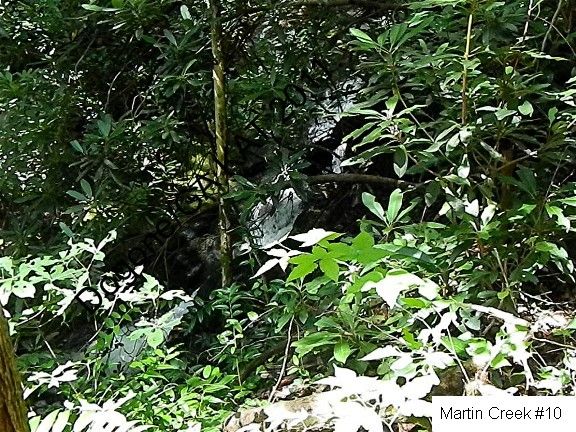
7/17/2011 - Went back to Martin Creek to get the GPS points and pictures of the falls I didn't get before.  There were a lot more than I remembered!  Some of them are hard to see, but as usual when you are there the water catches your eye and makes them easier to find.  This time I followed the instructions on Mr. Anthony's site, because it's a lot shorter hike.  Too darn hot to do a long hike!

I found 10 new falls altogether, in addition to Martin Creek Falls.  There are 2 or 3 places where it sounds like there might be other falls, but the creek is hidden from view by the overhanging bank - so I can't be sure.

The shorter trail that Mr. Anthony has starts in a camping spot, and then crosses Martin Creek.  It goes upstream for a little way that is level, then it starts the climb up to the valley.  It's not a bad climb.  At the top of the hill the Bartram Trail comes in from the left and you stay on this trail upstream all the way to Martin Creek falls.

The Bartram Trail crosses the creek, though it's not really necessary to do this, as it goes to the deck at Martin Creek Falls and then does a U-turn back almost to the first bridge...but staying on the trail and crossing the creek gives you a better view of the small falls below Martin Creek Falls.

5/22/2010  I got to these falls, via the Bartram Trail out of Warwoman Dell east of Clayton, GA, on a hike with the TrailDames.  This is about a 1.8 mile (3.6 round-trip) hike to Martin Creek Falls, that goes past Becky Branch Falls just 1/4 mile from Warwoman Dell.  Both falls are beautiful and well worth the hike.  There are also several smaller cascades along the creek on the way to Martin Creek Falls. (see also the entry about the falls in Warwoman Dell)

The trail is not too difficult, more or less ordinary mountain hiking in Georgia - up and down, up and down!  Just before the viewing platform for the falls, you cross a "picked clean" camping area and can either cross the creek on the bridge to get to the falls, or stay beside the creek and get to it that way, without crossing the bridge.  If you stay on the campground side, and hike past the side trail to the falls, there is a short, steep trail to the top of the falls and a small place that is nice for a picnic

I discovered the first falls are visible from the road, above the parking, but are not visible from the shortcut trail up the valley.  This might not be on Martin Creek.  GMAPS shows a creek coming in from the side and these falls might be on that unnamed creek.
GPS: 34°53'31"N 83°20'38"W

 
Upper
 
 
Lower

 
GPS: 34°53'29"N 83°20'42"W

  
This is the 2nd falls, buried in rhododendron.
GPS: 34°53'29"N 83°20'43"W


These 2 falls are very close together...buried in rhododendron, of course!
GPS: 34°53'28"N 83°20'45"W


Here's the 5th falls...I won't mention the rhododendron again!
GPS: looks like I missed this one


These are 2 different angles on the same falls comples.  The 2nd is taken from just a bit closer than the first.
GPS: missed this one too


And this is the 6th falls.
GPS: and this one

  
Between the 6th falls and the next set of falls there is a long gap as the trail continues upstream along a more or less level high valley.  Then the trail crosses Martin Creek, so the next falls are from the other side...and the main falls, Martin Creek Falls, is at the head of the valley. 
 
These are numbers 7 and 8 - very close together
GPS: 34°53'33"N 83°20'56"W


And this is the last small falls, then you cross the bridge back over the creek to the deck at the base of Martin Creek Falls. 
GPS: 34°53'33"N 83°20'56"W
GPS: 34°53'34"N 83°20'57"W
 

Directions and Information: from Clayton, GA
  • east on Rickman St
  • (if you miss Rickman St, Warwoman Rd is the next road to the right)
  • at 5 way junction, bear right onto Warwoman Rd
  • left on Finney Creek Rd
  • park at campsite on left, where road starts up steepish hill
Note: to see the first falls, continue past the campsite, up the hill to the first sharp curve to the right.  Park here and waterfall is distantly visible across the valley.  You can also hike to this falls by parking in Warwoman Dell and take the Bartram Trail up out of the Dell, across the road, and past Becky Branch Falls (separate blog entry)  It's about a 2 mile hike. 

Sarah's Creek (FS 155 & FS 155A) (12 falls)

6/22/2013 - went back up to the Clayton area to get videos of some waterfalls.  Heck, I could probably spend a month just in Rabun County and STILL not see all the falls that are there!

4/17/2011 - I just had to go back to the same route as yesterday and get the pictures I missed.  And I got mad at myself all over again when I found I had a set of spare batteries with me that I forgot about!  Anyway, my sister and I went back today and with her help we found a waterfall - a really nice one - that I totally missed yesterday.  This one is on Sarah's Creek just before you arrive at the entrance to the campground, and it looks like the first campsite on the left has a short trail down to it.

4/16/2011 - had a successful and yet frustrating day.  Set out to find the Forest Service campground on Sarah's Creek.  Turned out to be easy to find.  It's east of Clayton, GA and up the road named (TADA!)  Sarah's Creek Rd, off of Warwoman Rd.  It's paved up the steepest part of the drive, then is a pretty good gravel road from there.

I drove up through the camping area and found 2 small waterfalls on a branch flowing into Sarah's Creek, then a falls below where the road (FS 156) fords the creek.  This one is in that grey area between a true falls and a steep shoals, but I would call it a falls, so I included it.  I didn't ford the creek.  It was flowing pretty heavily due to the rain last night and I didn't want to take a chance of getting stuck.  I might go back when there's been less rain and see what's above the ford.

I drove back down the road and then turned west on FS 155.  Found several falls on this road, small ones...and the frustrating part happened.  My camera batteries died and the spares I had with me were dead too!  So I got several falls on both FS 155 & FS 153, but no pictures.  Will have to go back and get them.

Sarah's Creek
4/17 - went back and got a falls I missed yesterday.  Very nice falls, just before you enter the campground.  Also got an interesting hollow in the rock on the far side of the base of the falls, and some nice flowers on the road above the falls.
GPS 34°55'30"N 83°15'42"W (Sarah's Creek)


4/16 - I didn't get mileages, forgot to reset my odometer...but I did get GPS coordinates.  The first falls is on the 2nd of 2 branches that are close together at a curve in the camping area.  Park past the 2nd creek and then go back and walk up through the fairly clear area between the 2 branches.  The lower falls is visible from the road, and the upper falls is at the top of the clear area.
GPS 34°56'9"N 83°16'11"W (unnamed branch, flow into Sarah's Creek)


After passing these 2 branches, continue up FS 156 to where it fords Sarah's Creek.  Before you get to the ford, you go up a long hill and it sounds like there might be at least 2 falls along here, but you can't see the creek...you can only hear them.  Stop before the ford, and bushwhack down to the creek, down stream of the ford.  It's just a very short drop.  There are 2 small falls here.
GPS 34°56'21"N 83°15'53"W (Sarah's Creek(

 
To get to FS 155, go back down through the camping area and FS 155 turns off to the right. 

FS 155
4/17 - went back and got the lower falls I missed yesterday.  The falls I got yesterday is at the first of 2 small branchs that are close together.  Found there is a small falls on the 2nd creek, below the road.  You can see it by crossing over when you are below the road to see the lower falls on the 1st creek.  It's hard to see in the photo because of all the rhododendrons.

4/16 - found a falls that is just visible from the road, and then there is another on the other side of the road.  I only got a picture of the upper falls, my camera batteries died. 
GPS: 34°56'26"N 83°18'37"W (unnamed branch, flows into Hodds Creek)


Then further down FS 155 there is another falls just visible from the road.  There is a camp spot here, on the right.  Park here and walk upstream through the camp spot to view the falls. 
GPS: 34°56'19"N 83°18'53"W (unnamed branch, flows into Hodds Creek)


A short way beyond this falls is a sign that says FS 155 dead ends, and FS 155A goes off to the left.  There aren't any falls that I found on FS 155A, but this road ends at the junction with FS 153, which goes straight ahead and to the right.  There are several falls on FS 153.

FS 153
There is a falls right alongside the road, just before a high downed tree that spans the road.  The road runs beside this creek for quite a long way and there are several falls and pretty shoals in this creek.
GPS: 34°54'21"N 83°17'51"W (unnamed branch, flows into Tuckaluge Creek)
 

Further down is an area that sounds as if there might be 2 or 3 falls, but I could only see one of them
GPS: 34°54'14"N 83°17'53"W (unnamed branch, flows into Tuckaluge Creek)


Then there is one more small falls distantly visible upstream of this same creek.  Also got a picture of some nice flowers beside the road.
GPS 34°54'8"N 83°17'59"W (unnamed branch, flows into Tuckaluge Creek)


FS 155A comes out on Tuckaluge Creek Rd, which meets Warwoman Rd west of Sarah's Creek Rd.

Directions and Information: from Clayton, GA
  • east on Warwoman Rd
  • north on Sarah's Creek Rd (becomes FS 156)
  • FS 155 meets FS 156 just below start of camping
  • FS 155A meets FS 155 just before FS 155 dead ends
Notes: the gravel roads were in pretty good shape, just a bit potholed in a few places.  It looked like a lot of new gravel had been put down recently.  With all the rain we've had, in places the road was running water - but was still firm.